Civil 3D enhancements over the years

Autodesk Civil 3D was first released in 2005. In the past years, Autodesk developers have added a wide range of enhancements. Today Civil 3D design software is a powerful solution for civil engineers and includes purpose-built tools for critical civil engineering disciplines such as road and highway design, site design, and rail design.

Civil 3D over the past 7 years

7

Releases


15

Updates


268

Enhancements


Civil 3D enhancement timeline

2025 feature enhancements for Civil 3D

  • New unified coordinate system​
  • Core Performance Improvements​
  • Corridor improvements: Updates to property dialog box, new corridor surface creation, corridor smart update​
  • Surface improvements: level of detail flexibility​
  • ArcGIS® Basemaps​

2024 | 2024.1 featured enhancements for Civil 3D

  • New subassembly deployment and management​
  • Corridor transitions: corridor design workflows​
  • Connector for ArcGIS: Import objects from ArcGIS as AutoCAD point/polyline/polygon​
  • Pressure network: layout and editing enhancements​
  • Project Explorer: now available in Civil 3D installer​
  • API enhancements: rail turnout support​
  • Performance enhancements​
  • Twinmotion for Revit: Infrastructure Workflows​
  • IFC 4.3 extension for Civil 3D​
  • Autodesk Assistant​
  • Dynamo for Civil 3D enhancements​

2023 | 2023.1 featured enhancements for Civil 3D

  • Label display control​
  • Corridor transition and property set enhancements​
  • New subassembly composer dialogue box​
  • Pressure networks: connect and disconnect pipes to structure​
  • New in Rail workflows: turnout catalog and US catalogs updated​
  • API enhancements​
  • Dynamo for Civil 3D enhancements​
  • Performance enhancements​

2022 | 2022.1 | 2022.2 featured enhancements for Civil 3D

  • Corridor Workflows Enhancements
  • Rail Workflows Enhancements
  • Pressure Networks Enhancements
  • Performance Enhancements
  • New in Collaboration for Civil 3D
  • Project Explorer Enhancements
  • Grading Optimization
  • API Enhancements
  • Dynamo for Civil 3D Enhancements
  • Alignment Workflows Enhancements
  • ArcGIS Workflows Enhancements
  • User Profile

2021 | 2021.1 | 2021.2 | 2021.3 featured enhancements for Civil 3D

  • Design Efficiency Updates
  • Collaboration and Data Exchange Updates
  • Integration of the Autodesk Civil 3D 2020 Update Releases
  • ArcGIS workflow enhancements
  • Pressure network workflow enhancements
  • Feature Line Editing
  • Rail Bands in Profile Views
  • Autodesk Collaboration for Civil 3D
  • Layer Control for Bridge Workflows
  • Gravity Network Analysis Enhancements
  • API Enhancements

Infrastructure cityscape image with a highway focus and a blue digital overlay. This infrastructure image depicts a fictional rendered cityscape showing: roads and highways, road rehabilitation, rail with overhead catenary and sleepers, tunnel, bridge, water structures, canal, water treatment plant, airport, land development and earth movement, and underground utilities. Captures the following Autodesk infrastructure segments in a single image: Transportation, Land, and Water.

2020 | 2020.1 | 2020.2 | 2020.3 | 2020.4 featured enhancements for Civil 3D

  • Design Efficiency Updates
  • Production Efficiency Updates
  • Collaboration and Data Exchange Updates
  • Updates to the Corridor Rehab Subassemblies
  • Roadway Design Standards
  • Dynamo for Civil 3D Enhancements
  • Changes to Autodesk Civil 3D Drawing Templates
  • Interoperability Between Versions

2019 featured enhancements for Civil 3D

  • Design Efficiency Updates 
  • Production Efficiency Updates 
  • Collaboration and Data Exchange Updates 
  • Updates to the Overlay Slope Options in the Corridor Rehab Subassemblies 
  • Changes to Autodesk Civil 3D Drawing Templates 
  • Interoperability Between Versions

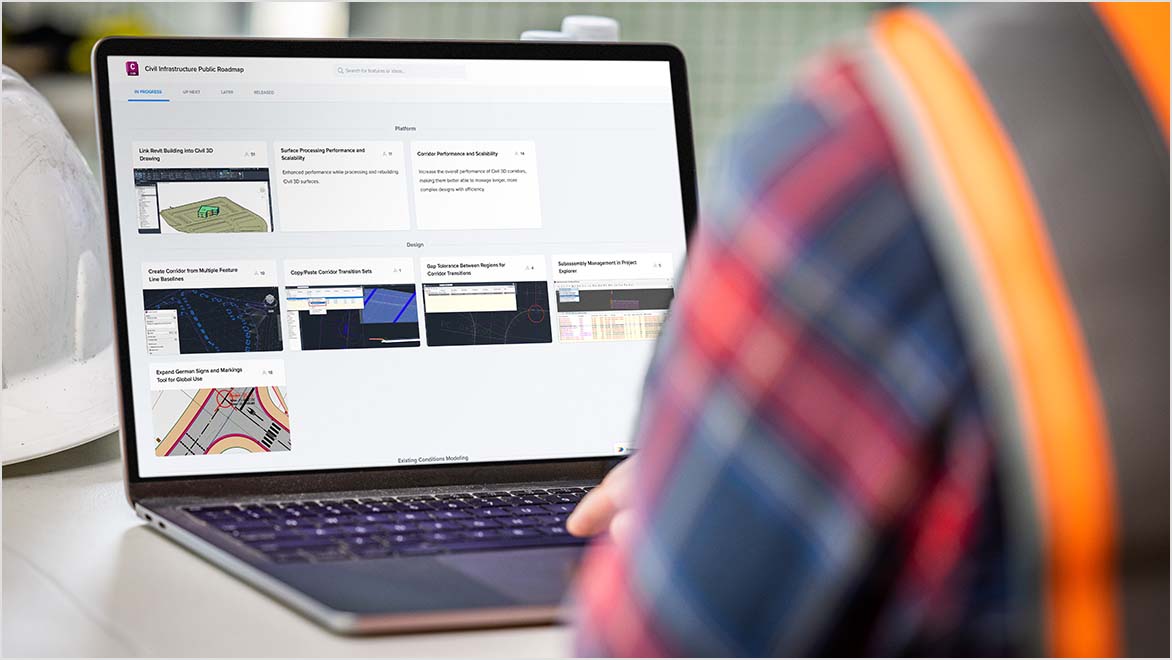
Civil 3D product roadmap

See what’s new and what’s in the pipeline with Civil Infrastructure Solutions Public Roadmap. Vote for the roadmap items you find most important.

Customer ideas help us define what's next in Civil 3D

The Autodesk Civil 3D development team are passionate about their roles and delivering on continuous improvement with every release. Please take a couple of minutes to watch the video as two members of the product team share how they value customer feedback.

Have an idea for making Civil 3D better? Visit Civil 3D Ideas to find, post, and vote on enhancements you want to see in Civil 3D.

Meet some of the Civil 3D Product Team

Ramesh Sridharan

Sr. Manager, Software Development Autodesk

Tim Yarris

Product Manager, Autodesk

Join & contribute to Autodesk AEC Community

Autodesk Community is your place to share your knowledge, start a discussion, and be inspired by designers and makers like you. Find out how you can get involved, give back, and connect with the community on topics that matter to you.

Take part in Community Conversations events

Join live events to connect with the community, learn about workflows and projects, and participate in discussions.


Start a discussion on the Community Voices blog

Subscribe for stories, workflows, and discussions on industry topics and trends contributed by the community. 


Contribute to Community Tips for AutoCAD

Add your know-how to our living library of AutoCAD user tips – from how-to knowledge to shortcuts.


Get answers & help others in Community Forums

Get answers to your questions and give others a helping hand by sharing what you know on the Civil 3D Forums 


More Civil 3D Resources

Discover courses and modules designed to help you meet your unique learning goals. 


Your source for information on the direction of software development, insider tips and tricks, and industry trends.


See how Civil 3D can help you design and build better roads and highways, sites, and rail projects.


Explore value delivered in other AEC solutions