& Construction

Integrated BIM tools, including Revit, AutoCAD, and Civil 3D
& Manufacturing

Professional CAD/CAM tools built on Inventor and AutoCAD
Discover key functionalities of Autodesk InfoWater Pro that help hydraulic modelers effectively plan, design, and operate water distribution systems.
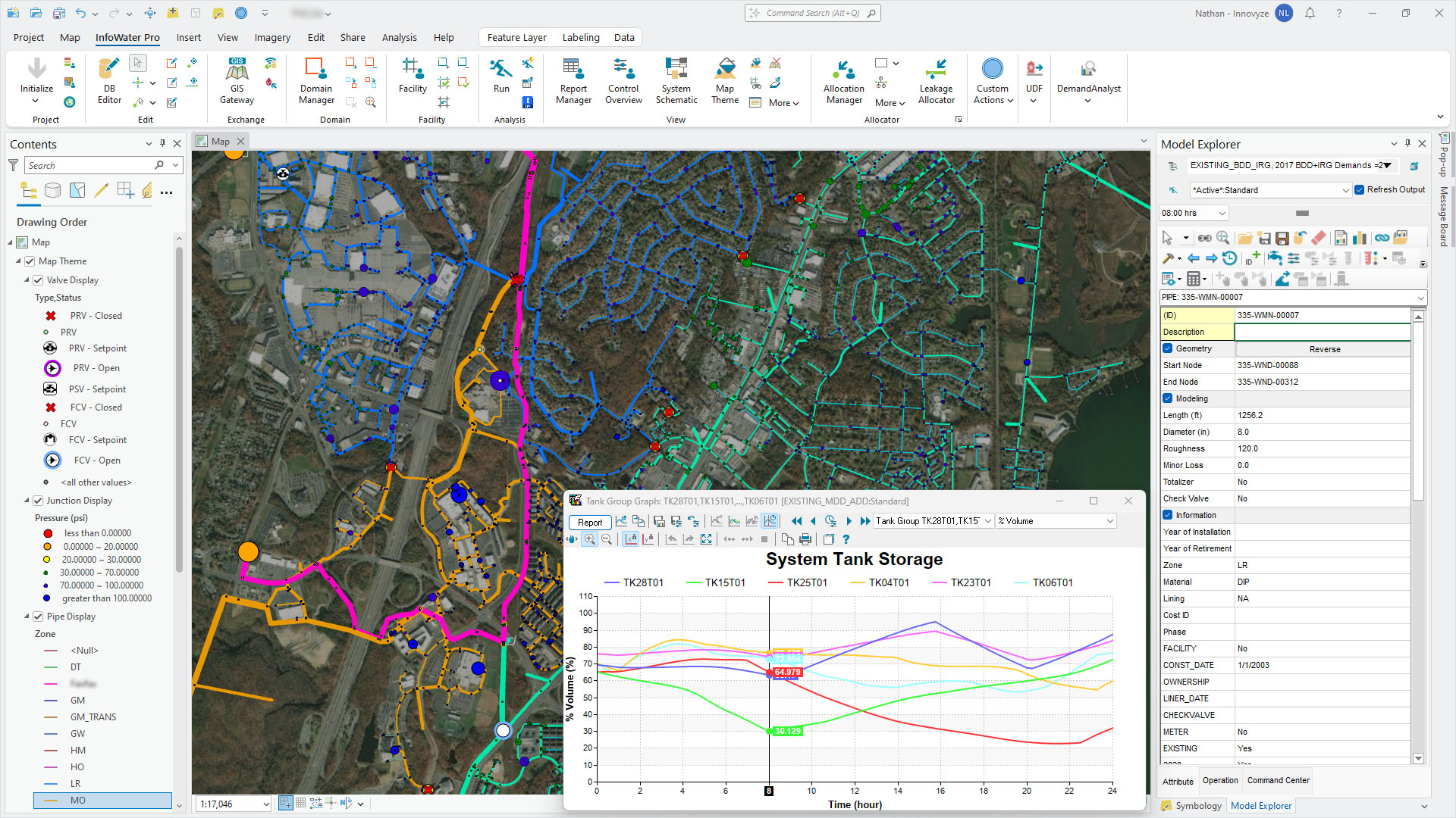
Use geospatial tools to efficiently build and edit models, present results, and generate maps
Be more confident in your model by connecting external telemetry data for continuous verification
Create, analyze, and compare what-if scenarios to understand the impact of model modifications
Quickly view the entire model in a schematic view and get a performance summary of each zone
Get more realistic results during outage simulations with water models
Easily confirm fire flow capacity by evaluating and improving the readiness of the water supply to fight fires, locally or in the cloud
Analyze the movement and concentration of a single constituent or multiple interacting chemical species
Model water age to control odors and find the percentage of water originating from a specified location
Prioritize expenditure for maintaining the serviceability of key assets by ranking critical valves
Reduce non-revenue water and accurately model pipe leakage throughout your network with pressure-driven leakage modeling
View model data in new ways and understand results with 3D visualization
Simulate surge events and test the effectiveness of hammer protection devices, with local or cloud simulations
NEW
Leakage modeling
Pressure-driven leakage is now supported directly on pipes and junctions for full leakage modeling capabilities. (video: 1:06 min.)
NEW
Fire flow asset impact analysis
Asset Impact Reporting is now available from the fire flow tab of the Run Manager, allowing you to summarize the pipes with high velocities and junctions with low pressures based on the total aggregate of all simulated fire flows at hydrants. (video: 1:14 min.)
ENHANCED
Water quality simulation improvements
You now have the ability to run water quality simulations with initial state files. By implementing this, you can now significantly lower the run duration lengths for simulations like water age and chlorine decay analysis. (video: 29 sec.)
NEW
Map Themes
Map Themes enable management of shared sub-themes for varying thematic map views of the system. This new interface replaces the former Map Display window. (video: 1 min.)
ENHANCED
Cloud simulations
Run fire flow, water quality, and other analyses in the cloud, saving time and improving results efficiency.
Hydraulic Diagnostics Report
The Hydraulic Diagnostic Report includes warnings related to pumps, valves, and hydraulic disconnection, as well as temporarily closed pipes next to tanks during the simulation.
Control Center Overview
View a summary of rule-based controls, simple controls, initial status, remote valve controls, and variable speed pump controls in a single dialog box.
InfoWater Pro API with Python
InfoWater Pro installs with Python scripting support to directly interrogate and extract InfoWater Pro results. This allows modelers to leverage custom scripting and analyses with Python notebooks inside of ArcGIS Pro or other development environments.
Connection to Info360 Insight
If you don’t have access to SCADA systems within Live Data Adapter (LDA), connect to Info360 Insight to get data analytics and preview Info360 Insight patterns through LDA.
Improved Live Data Adapter
The SCADA Event Manager functionality allows you to create a library of separate SCADA Events that can be selected within Gap Analysis.
Demand allocator
Calculate and distribute demands based on both existing systems and future system conditions.
Protector
Model the propagation and concentration of naturally disseminated, accidentally released, or intentionally introduced contaminants and chemical constituents throughout the systems.
Pressure zone manager
Identify and delineate each pressure zone based on its boundary elements and generate a hydraulic schematic for each pressure zone.
Criticality assessment manager
Carry out a detailed assessment of the hydraulic impact of valve operations on customer service and score asset criticality.
Scheduler
Determine the most cost-effective pumping and valve policies to reduce costs and provide safer, more reliable operations.
Designer
Find out the most cost-effective, efficient design and rehabilitation of water distribution piping systems.
Pump system analysis
Design new pumping stations that meet pumping capacity requirements and maintain optimal pumping efficiency.
Skeletonizer
Reduce excessive pipe segmentation by dissolving interior nodes based on user-specified attributes, while automatically readjusting demands to construct reliable network models.
Back-tracing
Run in reverse time to compute input-output hydraulic and water quality characteristics for all flow paths between input sources and output nodes.
NetVIEW
Allow multiple water utility departments maximum interaction with spatial photography by publishing hydraulic models to Google Earth.
Calibrator
Determine pipe status and roughness coefficients, pump and valve status, and demand distribution to provide a well-calibrated model that best reflects actual system conditions.
Water quality calibrator
Adjust pipe wall reaction coefficients to provide a calibrated water quality model and best reflect actual water quality conditions in the distribution system.
Multi-species analysis
Perform advanced water quality analysis, assessing reactions between multiple chemical and biological contaminants.
